Sign Up. Stay Informed.
- Overview
- Project Benefits
- Funding
- Sediment Diversions
- Timeline
- Resources / Get Involved
- Community Outreach
About Sediment Diversions
To address the root problem of our state’s rapid coastal land loss, it is imperative to restore the natural processes that initially built our delta and “reconnect the river”. Controlled sediment diversions offer a unique opportunity to strategically re-establish hydrologic flows, carry land-building sediment, nourish marshes, and sustain land. When utilized with marsh creation projects and the full suite of protection and restoration projects outlined in the Coastal Master Plan, this integrated systems approach can combat the grave land loss that threatens our coast.
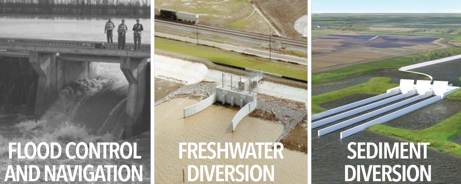
The concept of river diversions is not a new one. We have several other river diversions operating throughout our state. Structures at Caernarvon and Davis Pond were designed and constructed to control saltwater intrusion by delivering freshwater into the estuaries.
While freshwater diversions were not designed to build or maintain land, land growth has occurred at several of these sites. The images below show land growth over time at the outfall areas of Davis Pond and Wax Lake.

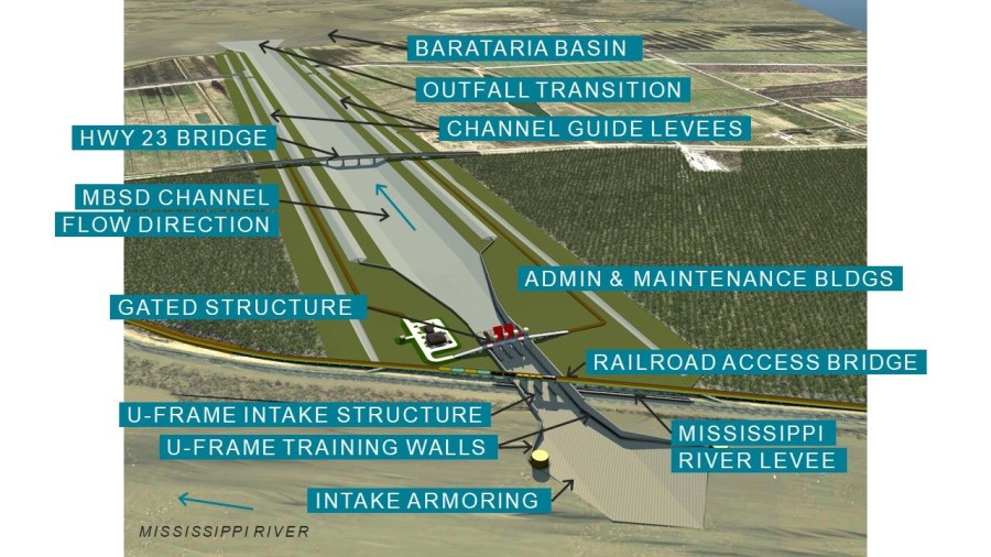
The Mid-Barataria and Mid-Breton diversions will be designed to serve a different purpose. Their primary and intended purpose will be to capture and divert sediment from the river and deposit it into the basins, restoring the river’s natural process and building and sustaining land in their respective basins.
Mid-Barataria
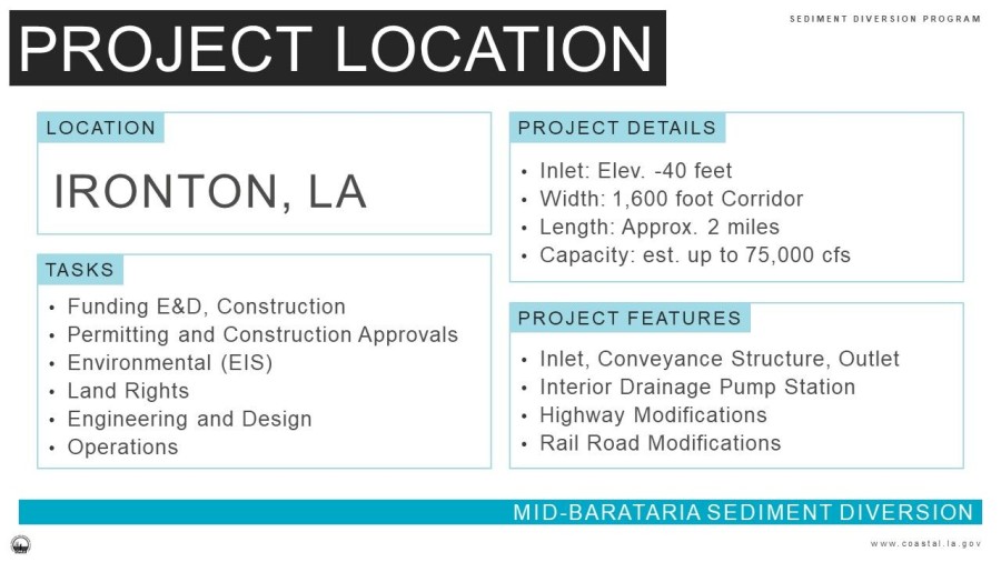
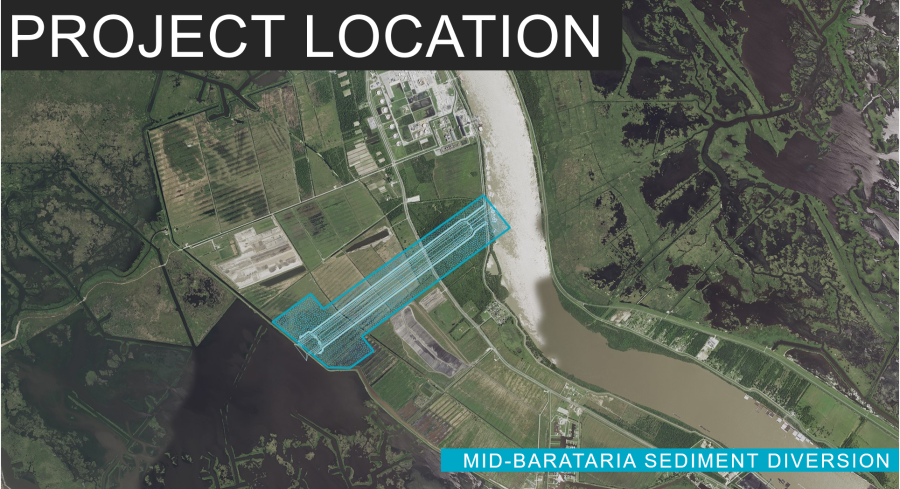
The Mid-Barataria Sediment Diversion structure will be located in Plaquemines Parish, LA, along the west bank of the Mississippi River, just north of the town of Ironton and south of the Phillips 66 Alliance Refinery near Mississippi River Mile 61.
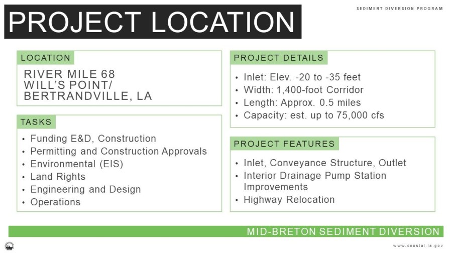
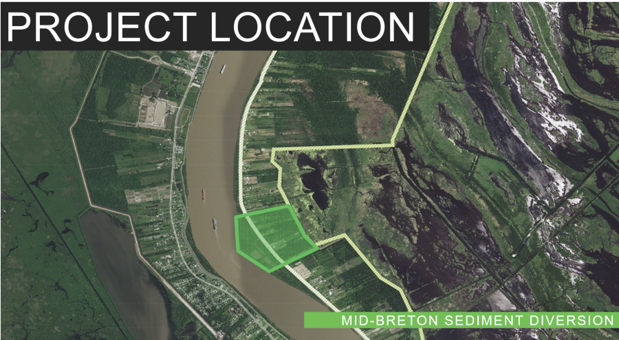
Mid-Breton
The Mid-Breton Sediment Diversion structure will be located in Plaquemines Parish, LA north of the Mid-Barataria location on the east bank of the Mississippi River, near Wills Point approximately at Mississippi River Mile 69.