February 27, 2019
You can’t comprehend the extent of land loss in coastal Louisiana until you see it from above. What appears on most maps as solid land and marsh can, from the air, be seen for what it truly is: a fragile green lace dissolving into open water. Conversely, the expanse and scope of what Louisiana is achieving in its restoration efforts are also most evident when seen from above.
That is why Louisiana Gov. John Bel Edwards took to the air recently, flying over Terrebonne and Lafourche Parishes to see the challenges facing state and local government, and to view the accomplishments made since Hurricanes Katrina and Rita. Louisiana Coastal Master Plan projects and the inspirational “we’re not waiting on anybody” attitude of the local governments have made a visible difference and give hope for the future. There is much more to do, but there is also an obvious path forward.

Joining the governor on the Blackhawk helicopter tour were (from left to right)
Chip Kline, Chair of the Coastal Protection and Restoration Authority; Terrebonne Levee and Conservation District President Tony Alford; South Lafourche Levee District President Ronald Callais; South Lafourche Levee District General Manager Windell Curole; North Lafourche Levee District Executive Director Dwayne Bourgeois; Gov. John Bel Edwards; North Lafourche Levee District President Cory H. Kief; Office of Community Development Executive Director Pat Forbes; La. DOTD Secretary Shawn Wilson; and Reggie Dupre, Jr., Executive Director of the Terrebonne Levee and Conservation District.

Lifting off from the Houma Terrebonne Airport, the helicopter flew a roughly clockwise path, taking the group over the North Lafourche Levee Alignment and CPRA-involved projects such as the 40 Arpent Canal Levee, the Hollywood Canal Closure Structure, Levee Improvements for the Gheens Community, the Valentine to Larose levee, and the Kraemer Bayou Boeuf Levee Lift.
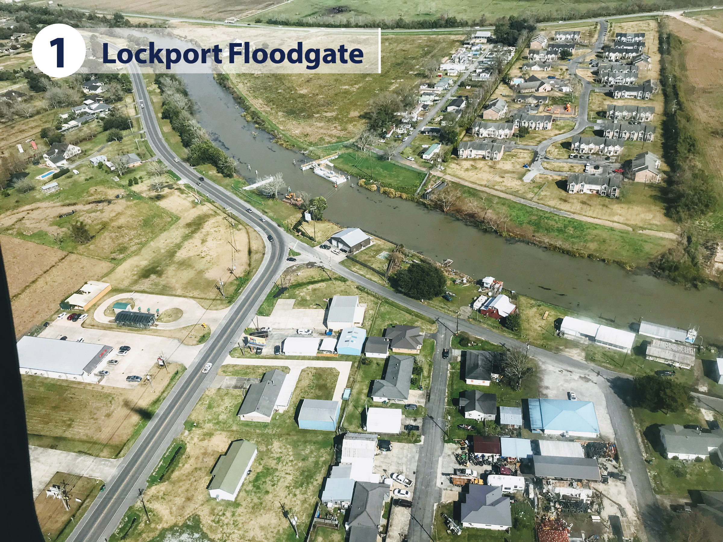
Floodgates within the impressive Larose to Golden Meadow levee system have been successful in making Bayou Lafourche a safe harbor for boats moving away from the coast when tropical storms or hurricanes threaten. The Lockport Floodgate is a barge gate, while downstream a lock system protects the southern entryway at Golden Meadow.
“What I saw today was remarkable. While there is much more to do, it is incredible to see what the residents of Lafourche and Terrebonne parishes have been able to accomplish on their own, and I applaud them for not leaving their fate in the hands of others. The state and CPRA will continue to support and assist you, but I believe we all recognize that it will take our federal partners coming on board to provide the funding necessary to bring this area up to the federally-mandated standards. The people of these parishes are a shining example of resilience for our state and nation.”
– Louisiana Gov. John Bel Edwards

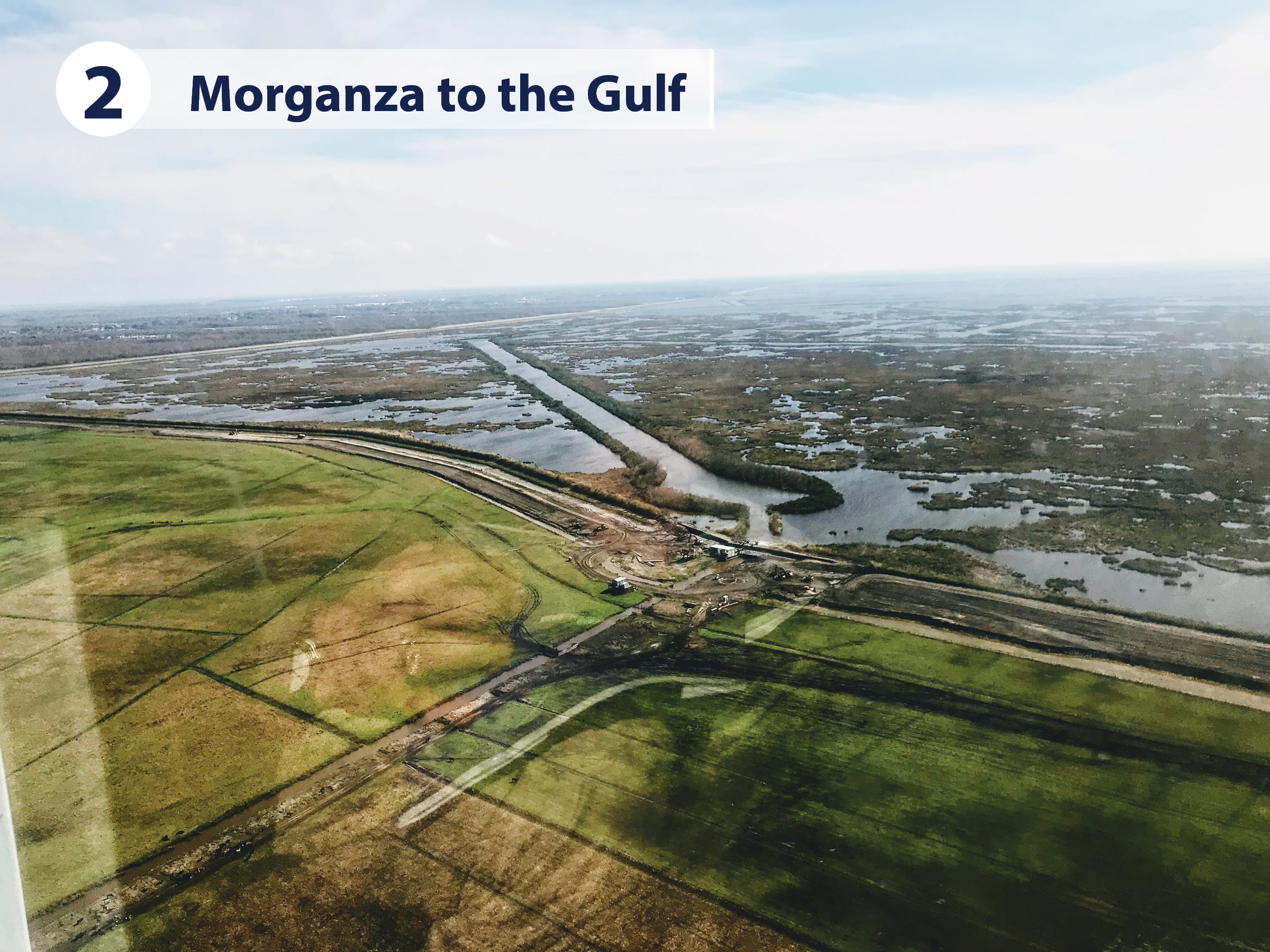
“We cannot wait, and we will not wait,” is the message the people of Lafourche and Terrebonne Parishes have sent to the federal government which has so far contributed no money to the construction of the long-planned Morganza to the Gulf levee system. Putting their money where their mouths are, the citizens of Lafourche and Terrebonne taxed themselves and began construction of the 98-mile lock, levee, and floodgate system. With financial help from the state, approximately 150,000 residents and 1,700 square miles of wetlands are protected and thriving.
Not only is the levee system and its flood gates protecting against storm surge when it occurs, but it is also keeping creeping salinity levels at bay, and the freshening of the marsh system behind the levees is ample evidence that fresh water and its nutrient load can naturally provide mitigation against the encroaching Gulf.
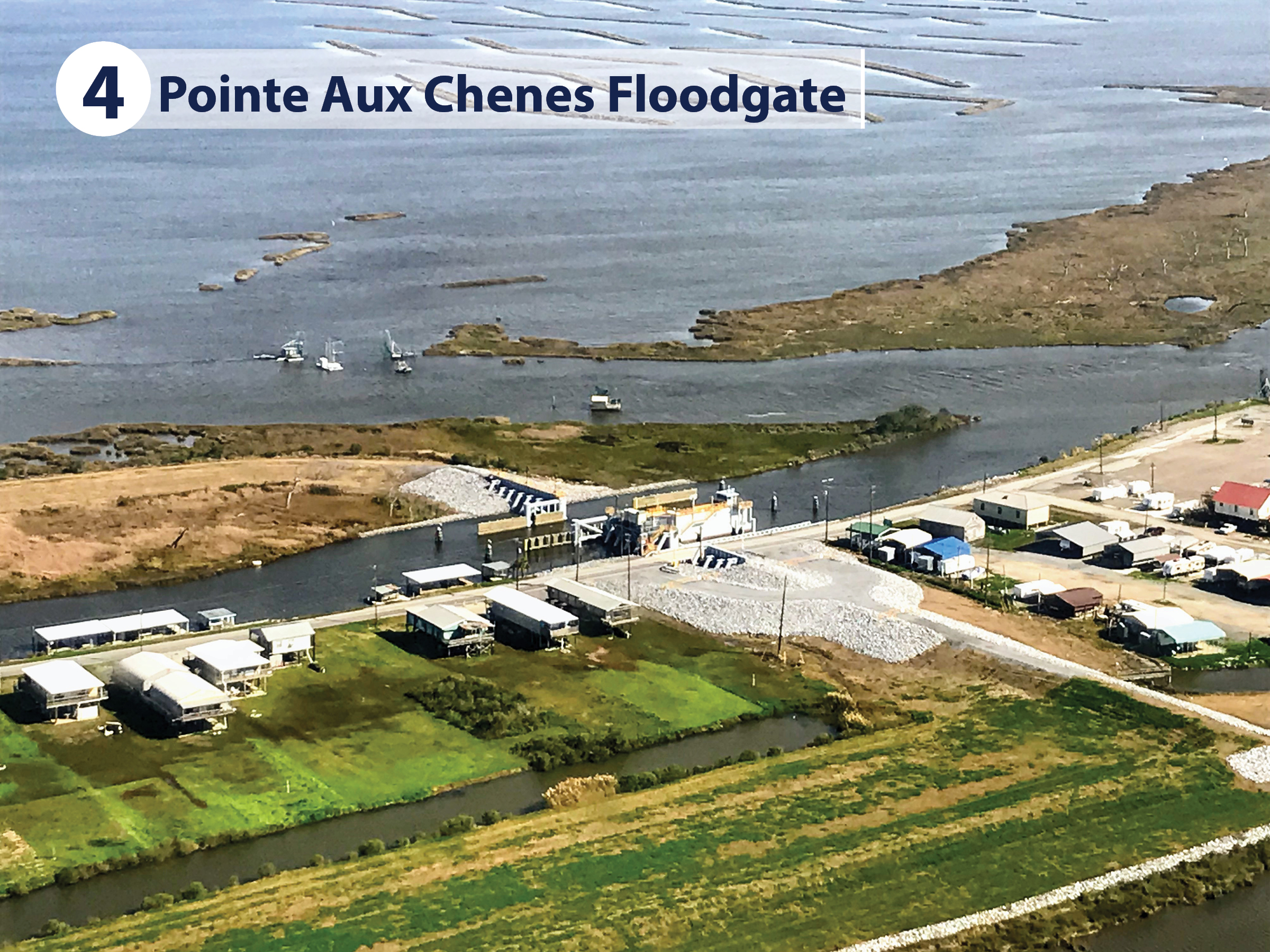
The governor’s tour viewed various components of the locally-funded levee system, including structures that are open most of the time but can be closed when a storm approaches. The Pointe Aux Chenes Floodgate is one of the component structures built into the 98-mile levee. The openings for navigation and land vehicles may be closed using a barge gate and a highway roller gate.
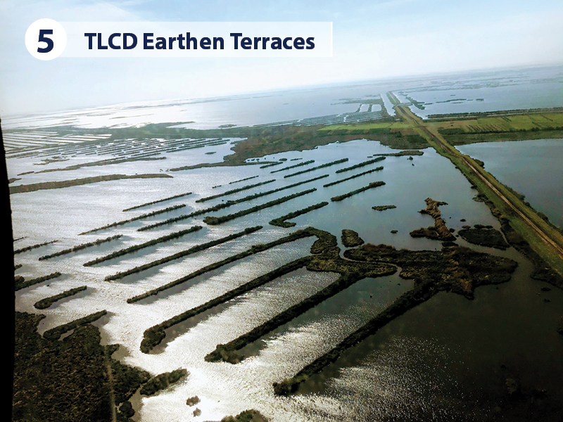
Across the Terrebonne Levee and Conservation District (TLCD), marshes are being created, and ridge structures are used to absorb wave energy and allow sediment to accumulate and fill in open-water areas.
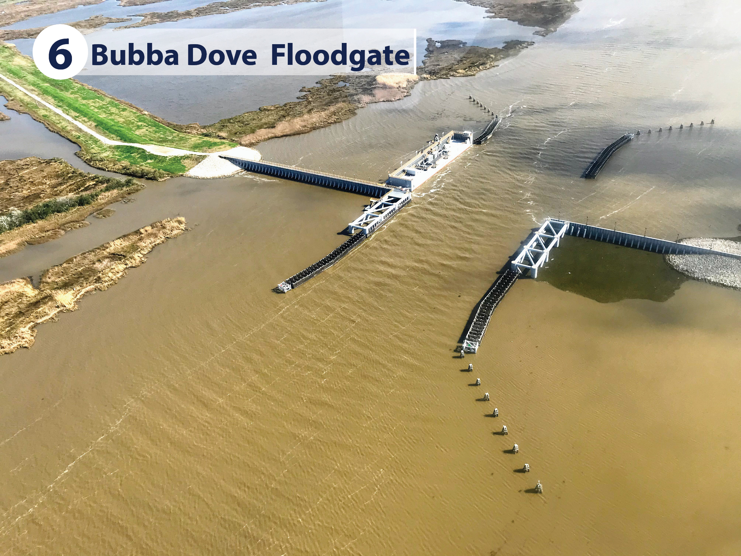
The major commercial waterway in Terrebonne Parish is the Houma Navigation Canal. The Bubba Dove Floodgate across it was locally and state-financed, constructed without any federal funds. More is being built at this structure, with a lock system being installed adjacent to the gated opening to facilitate traffic at crucial times when the large barge gate is closed.
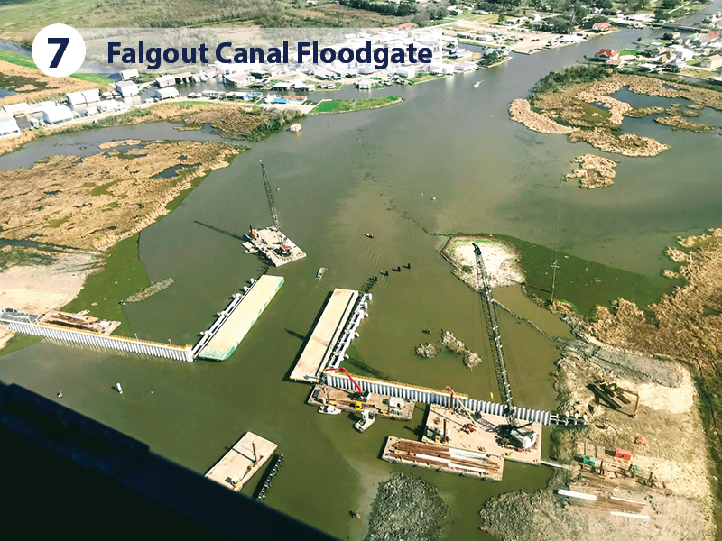
Similarly, floodwalls and floodgates on the Falgout Canal, and Upper and Lower Bayou Dularge are open to navigation but are closed when storm surge approaches.
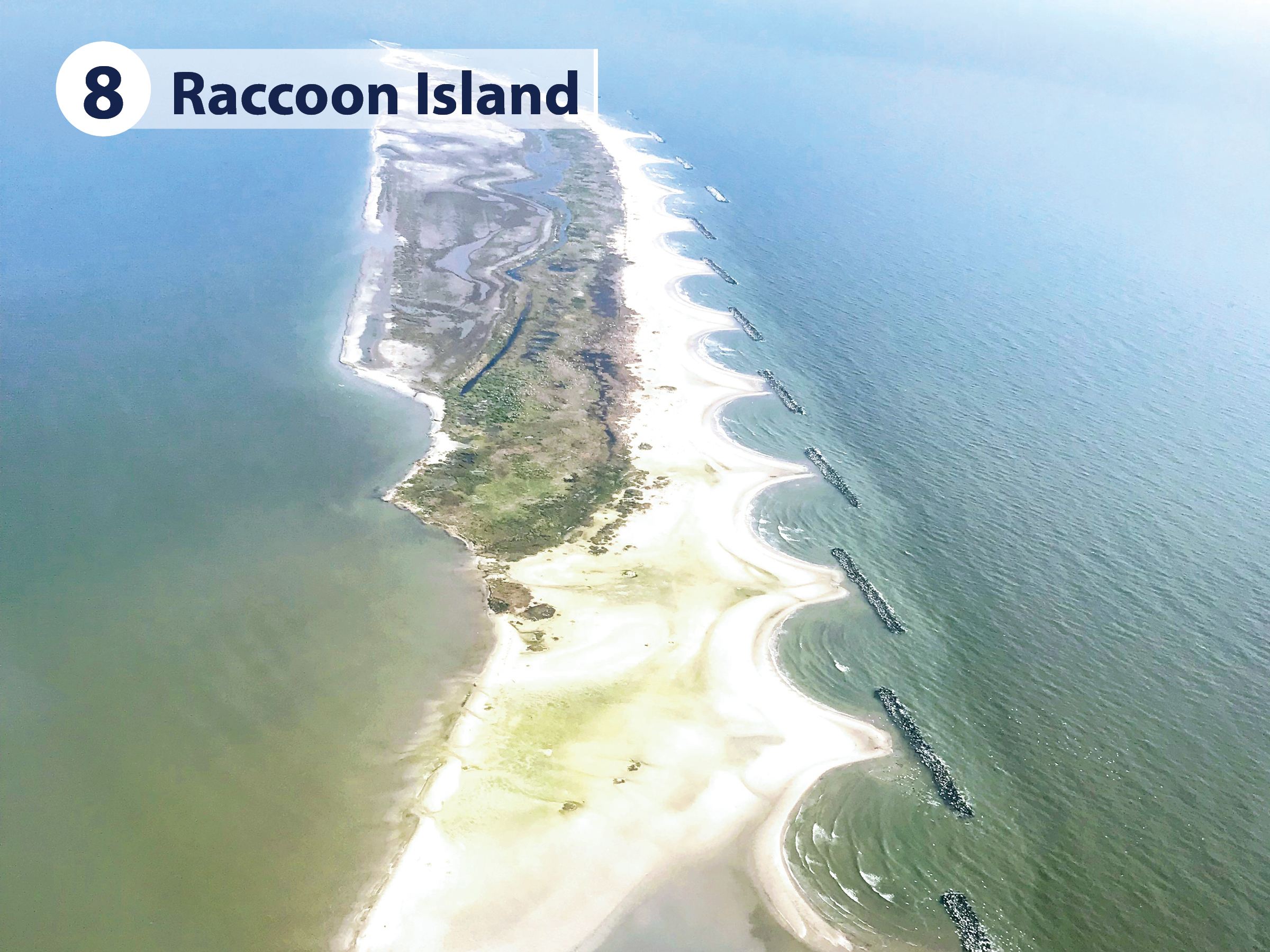
Continuing the flight along the southernmost reaches of Terrebonne and Lafourche Parishes, the group got an aerial view of the coastal perimeter and barrier islands that have been or will be beefed up to provide the first line of defense against tidal and storm surge. Raccoon Island’s protective rock shoreline structures have allowed sand to accumulate and helped to protect rookeries and seabird colonies.
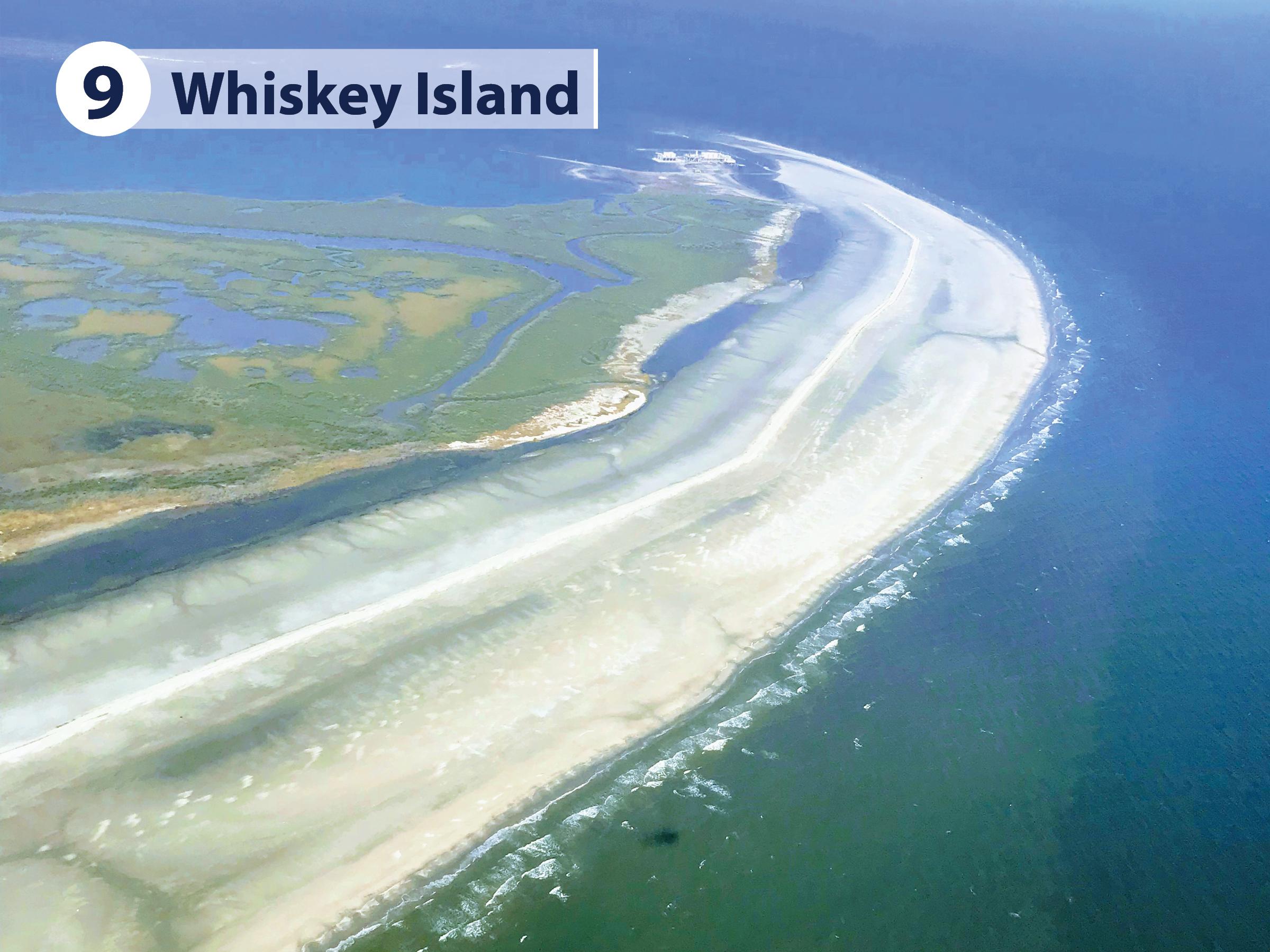
Whiskey Island was once part of the much-larger Isle Derniere that began breaking apart in the mid-1800s. This is the most recent barrier island reconstructed by CPRA, using 100 percent funding from the Natural Resources Damages Act (NRDA), oil spill settlement funding. Approximately 10.5 million cubic yards of sand were dredged from offshore to create or restore 954 acres of beach, dune and nearshore habitat, CPRA’s largest restoration project by cubic yards of sediment pumped.

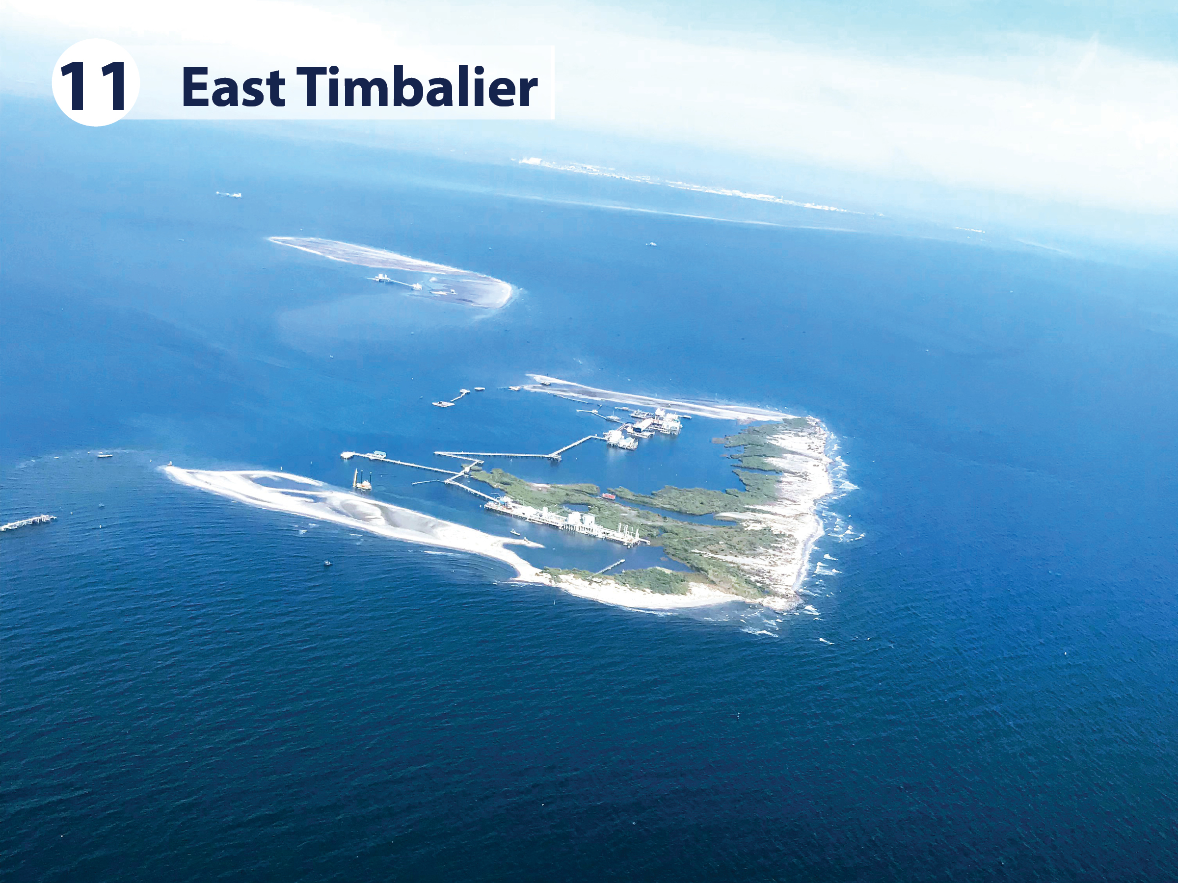
Beaches, dunes, and marsh habitat will soon be restored on the Timbalier Islands, Trinity Island, and West Belle Headland using $150 million in post-oil-spill funds supplied by the National Fish and Wildlife Foundation, oil spill settlement funding.
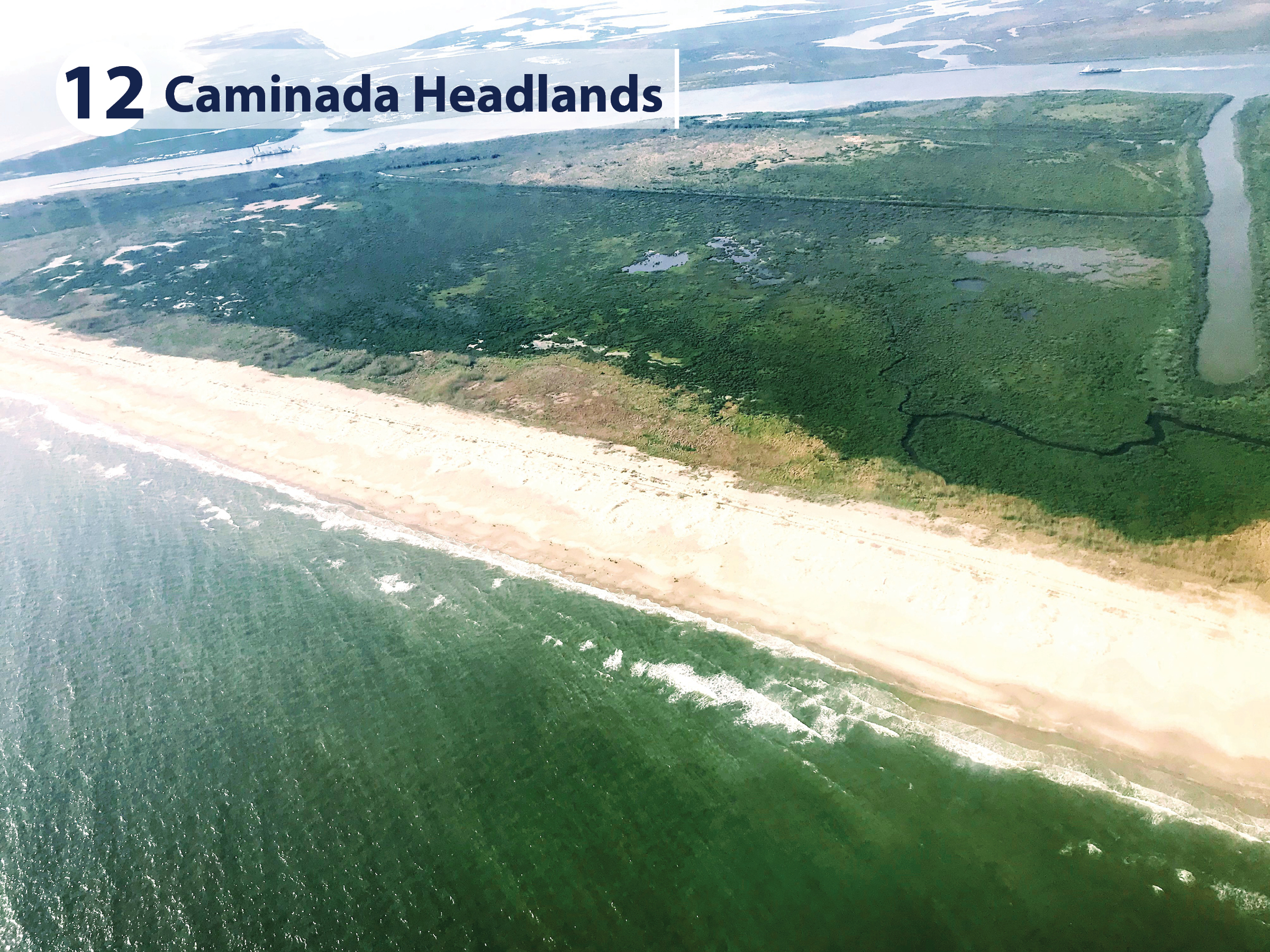
Also on the perimeter of the Gulf of Mexico below Port Fourchon are the recently restored Caminada Headlands and adjacent Elmer’s Island, CPRA’s largest restoration project by acreage and cost.
Upon landing back at the Houma Terrebonne Airport, Chip Kline, Governor Edwards’ Executive Assistant for Coastal Activities said he was struck most by how the structures and reconstructions are not only fulfilling their intended protection duties; they are also having a positive impact on the environment.
“We talk about mitigation, but these man-made structures were built in such a way that they are basically self-mitigating. We see a very positive effect on the marsh and wetland environment behind the constructed areas. They are reversing the withering effects of salinity intrusion that comes with storm and tidal surge. In this case, protection is restoration and resurgence, too.”
–CPRA Chairman Chip Kline
Become a Coastal Advocate!
Learn more about your current and future flood risk.
Visit the Master Plan Data Viewer.
Click here to subscribe to our blog and coastal updates.
Connect with Us! @LouisianaCPRA