Sign Up. Stay Informed.
Caernarvon and Davis Pond Diversions
2026 Operations Plans:
Caernarvon Operations Status Update:
Caernarvon Discharge (USGS site 295124089542100)
Black Bay nr Snake Island (USGS site 07374526)
Caernarvon 15ppt Gage: Black Bay nr Stone Island (USGS site 07374526)
Caernarvon 5ppt Gage: Crooked Bayou (USGS site 073745257)
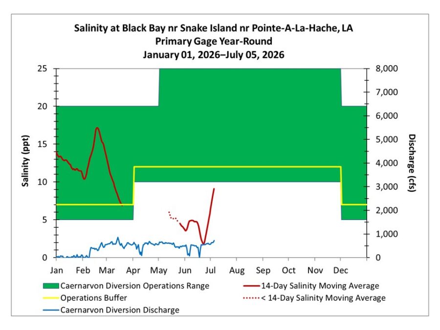
2026 Caernarvon Freshwater Diversion mean daily discharge and 14-day salinity moving average at the Snake Island nr Pointe-A-La-Hache, LA gage through 07/05/2026. Data are considered provisional until approved by USGS. The status of the data (provisional or approved) is posted on the webpage for each USGS gage. Salinity data at the Snake Island gage between 03/20/2026 and 05/12/2026 were removed from the database by USGS due to not passing data quality standards. The 2026 Caernarvon Freshwater Diversion Operations Plan bases operations on a salinity range for the eastern oyster (Crassostrea virginica). Additional details on how the diversion is operated are provided in the 2026 Operations Plan, which can be accessed through the Caernarvon Operations Plan link above.
Davis Pond Operations Status Update:
Davis Pond Discharge (USGS site 295501090190400)
Davis Pond 15ppt Gage: Barataria Bay nr Grand Terre (USGS site 291929089562600)
Davis Pond 5ppt Gage: Little Lake Bay Dos Gris (USGS site 292800090060000)
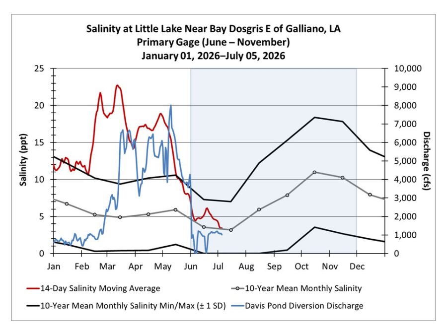
2026 Davis Pond Freshwater Diversion mean daily discharge and 14-day salinity moving average at the Little Lake near Bay Dosgris E of Galliano, LA gage through 07/05/2026. Data are considered provisional until approved by USGS. The status of the data (provisional or approved) is posted on the webpage for each USGS gage. The Little Lake gage is the primary gage used to guide diversion operations from June through November. These months are shaded on the graph. Additional details on how the diversion is operated are provided in the 2026 Operations Plan, which can be accessed through the Davis Pond Operations Plan link above.
Caernarvon Overview Information
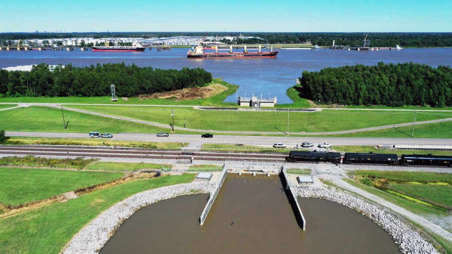
The project was authorized on October 27, 1965, by Public Law 89-298, of the 89th Congress, 1st Session. It is near Braithwaite, Louisiana, on the left descending bank of the Mississippi River in Plaquemines Parish at mile 81.5.
Davis Pond Overview Information
The project was authorized by the Flood Control Act of 1965, the Water Resources Development Act of 1974, and the Water Resources Development Act of 1986. It is near Luling, Louisiana, on the west bank of the Mississippi River in St. Charles Parish at mile 118.4.