Sign Up. Stay Informed.
Location
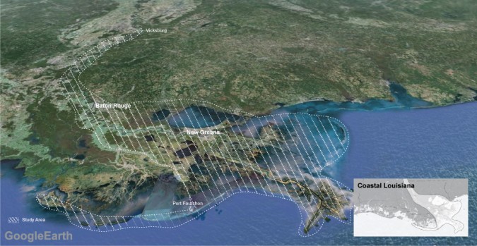
he Louisiana Coastal Area (LCA) Mississippi River Hydrodynamic and Delta Management Study (MRHDMS) area encompasses the lower Mississippi River and the surrounding deltaic regions (Pontchartrain, Breton Sound, and Barataria Basins). The hydrodynamic portion of the study focused on data collection and modeling tool development on the Mississippi River from Vicksburg to the Gulf of Mexico. The delta management portion of the study focused on both the Mississippi River and the surrounding deltaic regions.
Issue Addressed
Wetlands surrounding the Mississippi River Delta are experiencing subsidence and land loss which are compounded by the disruption of natural deltaic processes and altered bayside hydrology. Improvement in understanding and management of available Mississippi River resources (freshwater, sediment, and nutrients) is needed to support multiple river functions, including restoration, navigation and flood risk reduction. The project team designed and evaluated restoration strategies and project features meant to adjust bayside hydrology, re-establish geomorphic connectivity of the Mississippi River to the receiving basins, and introduce sufficient volumes of sediment, freshwater, and nutrients needed to build land.
Project Goals
The goal of the feasibility study team was to utilize modeling results and recommendations from other large-scale coastal restoration plans (including the Louisiana Comprehensive Master Plan for a Sustainable Coast, 2012) to provide a decision-making framework for the management of a sustainable coastal ecosystem that allows for the coexistence of navigation and flood control uses while supporting the needs of Louisiana and the Nation.
-
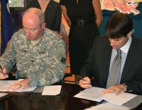
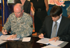
- Colonel Edward R. Fleming of the U.S. Army Corps of Engineers New Orleans District and Garrett Graves, Chair of the Coastal Protection and Restoration Authority of Louisiana, sign the cost-share agreement for the Mississippi River Hydrodynamic and Delta Management Study on August 24, 2011.
-
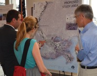
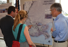
- Louisiana Coastal Area Program Supervisor Wes LeBlanc, of the Coastal Protection and Restoration Authority, discusses the study area with two stakeholders at a public scoping meeting in New Orleans on April 12, 2012.
-

- Project representatives from the Coastal Protection and Restoration Authority of Louisiana and the U.S. Army Corps of Engineers New Orleans District form an impromptu round table discussion on project goals with area stakeholders in Boothville, Louisiana.

Project Type: Key Initiative
Project Information:
Project number: MR-0016
Estimated Total Cost: $$25.4 million