Sign Up. Stay Informed.
NFWF Funded Projects
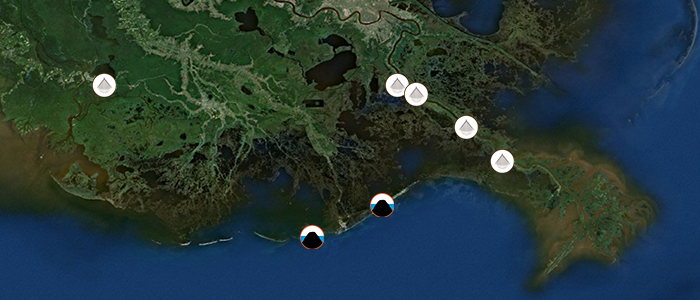
Click on a Project Icon to Learn More
Caminada Beach and Dune Increment II: Engineering & Design ($3M)
Lafourche Parish, Louisiana
Project Significance:
The Caminada Headland is a beach, dune, marsh, and maritime forest complex at the junction of Bayou Lafourche and the Gulf of Mexico. The project will create approximately 489 acres of beach and dune habitat; restoring approximately 8.9 additional miles (supplementing Phase 1) of beach with approximately 5.4 million cubic yards of material from an offshore submerged sand source (Ship Shoal). A restored beach and dune system will protect sensitive landward marshes and maritime forests from erosion and saltwater influences. In addition, these beaches and dunes serve as a source of sand for nourishing islands immediately to the east and west of the project, including Grand Isle- Louisiana’s only populated barrier island. The beaches and dunes also provide storm buffering to Port Fourchon. In conjunction with other ongoing work, restoration of Caminada Headland will complete restoration of the chain of barrier islands that define Barataria Bay, consistent with the goals of the Louisiana’s Coastal Master Plan.
Project Funding:
Funding obligated by the Gulf Environmental Benefit Fund will be utilized to perform engineering, design, land rights and permitting actions necessary for the second increment of the Caminada Beach and Dune Restoration project. The end result of this effort will be a set of construction bid documents intended to be released soon after completion to allow for construction to begin as early as spring 2014. The State previously directed $40 million in surplus state funding and $30 million in Coastal Impact Assistance Program funding toward constructing Phase I of this project.
Download the project fact sheet.
East Timbalier Island: Engineering & Design ($6M)
Lafourche Parish, Louisiana
Project Significance:
East Timbalier Island is part of a barrier island chain that separates Terrebonne and Timbalier bays from the Gulf of Mexico. The island is currently comprised of two severely degraded segments; the proposed project would re-establish the historic footprint, reconnecting the two segments.
East Timbalier Island has been severely degraded due to the impacts of several strong storms, subsidence and other factors. Historically, the island served to define the seaward boundary of the eastern Terrebonne Basin estuary, reducing the transmission of Gulf waves into Terrebonne Bay. This project is critical to maintain lower wave-energy environments in eastern Terrebonne Basin, which protects fragile interior marshes and infrastructure and provides quiescent bay habitats preferred by many fish and invertebrate species. In addition, the island provides critical beach, dune, and marsh habitat in isolation from the human disturbances that typically impact many gulf coast barrier islands.
Project Funding:
Funding obligated by the Gulf Environmental Benefit Fund will be utilized to perform necessary planning analysis to determine size and scope of the project as well as engineering, design, land rights and permitting activities. The end result of this effort will be a set of construction bid documents.
Download the project fact sheet.
Mid-Barataria Sediment Diversion: Engineering & Design ($40.4M)
Plaquemines Parish, Louisiana
Project Significance:
The Mid-Barataria Sediment Diversion project (aka Myrtle Grove) is regarded by many as one of the most important river reconnection projects contained in Louisiana’s Coastal Master Plan. This project, designed to mimic delta-building processes in the Atchafalaya River delta and others, will be instrumental in informing the design of other future diversion projects. The Mid-Barataria Sediment Diversion is expected to restore significant habitat in the Barataria Basin, including fresh, intermediate, and brackish marshes by re-introducing the sediment and nutrients which historically built and maintained the affected area. The Barataria Basin is projected to lose between 105,000 – 150,000 acres of land by 2060 depending on future environmental conditions. Implementation of the project as defined in Louisiana’s Coastal Master Plan is expected to reduce this loss by 20,000 to 32,000 acres of land in 50 years and will continue to reduce land loss beyond 50 years.
The main project feature is a controlled, gravity flow sediment reintroduction structure that would convey up to 75,000 cubic feet per second (cfs) of sediment laden water to the currently degrading wetland complex in mid-Barataria Basin. A new conveyance channel would be constructed across fastlands and levees to reconnect the Mississippi River to its historical floodplain in this area. Additional project features include a replacement of Highway 23 with a fixed span bridge over the new conveyance channel, coordination and modification to rail lines and associated bridge, forced drainage for the northwestern portion of the fastland area that will be isolated by the new conveyance channel, and pipeline and utility rerouting. Additionally, an Environmental Impact Statement will be prepared to support permit applications. A robust public engagement process will be an integral part of these regulatory processes.
The project concept was previously approved under the Coastal Wetlands Planning, Protection, and Restoration Act and authorized for construction by Congress under the Louisiana Coastal Area Ecosystem Restoration Near-Term Plan. Technical analyses performed by those two efforts and subsequent planning in conjunction with Louisiana’s Coastal Master Plan analyses have indicated that a 75,000 cfs structure optimizes land building and sustaining processes while minimizing potential adverse effects. Importantly, the Mid-Barataria project is projected to result in significant restoration and community resilience benefits as compared to no action and other project options.
Project Funding:
Funding obligated by the Gulf Environmental Benefit Fund will be utilized to for engineering, permitting, environmental data collection, stakeholder engagement and a portion of the land rights services pertinent to this project. The end result of this effort will be a set of construction bid documents.
Download the project fact sheet.
Lower Mississippi River Sediment Diversions: Planning ($13.6M)
Jefferson and Plaquemines Parishes, Louisiana
Project Significance:
The study will examine additional lower Mississippi River sediment diversions designed to reconnect the Mississippi River to degrading marshes east (Mid Breton and Lower Breton) and west (Lower Barataria), building land in shallow open water and introducing sediment and nutrients to sustain existing stressed wetlands. Planning for each of these projects will include robust stakeholder involvement. The diversion of water through these river reconnection projects will be planned in an integrated manner such that sediment and freshwater resources are optimized for maximum benefit within coastal Louisiana.
Retaining the sediment load of the Mississippi River within the coastal wetland complex has been a cornerstone restoration concept since at least 1990, most importantly being a part of the Coast 2050 Plan (1998), the Louisiana Coastal Area Ecosystem Restoration Near Term Plan (2005), and both versions of Louisiana’s Coastal Master Plan (2007 and 2012). The Barataria Basin is projected to lose between 105,000 – 150,000 acres of land by 2060 depending on the future environmental conditions. The Lower Barataria diversion is expected to reduce this loss by 9,000-11,000 acres. Without any restoration action, the Pontchartrain/Breton Basin is expected to lose 39,000 acres of land; the Mid Breton and Lower Breton diversions are expected to reduce this loss by 26,000-33,000 acres.
Project Funding:
Funding obligated by the Gulf Environmental Benefit Fund will be utilized to perform initial planning studies for sediment diversions in the lower Mississippi River. This planning effort is intended to result in a preferred location, size and operation regime for the diversion structures; an evaluation of the sediment distribution (river and basin side), flooding, fisheries, nutrients and economic effects of the projects; and a 10% conceptual design for each project. The planning studies are needed for these projects before engineering and design can commence.
Download the project fact sheet.
Increase Atchafalaya Flow to Terrebonne: Planning ($4.9M)
Terrebonne Parish, Louisiana
Project Significance:
The project will utilize freshwater and sediment from the Atchafalaya River in order to build, sustain, and maintain wetlands within the Terrebonne Basin. The proposed project area encompasses approximately 900,000 acres, and includes a large extent of coastal marsh south of the Gulf Intercoastal Waterway (GIWW) at Morgan City eastward to the Houma Navigational Canal and Houma. The lack of both freshwater and sediment inputs due to hydrologic alterations have resulted in increased saltwater intrusion and high subsidence rates in this area which has significantly contributed to wetland loss. The project concept as described in Louisiana’s Coastal Master Plan includes dredging of the GIWW east of the Atchafalaya River and installation of a bypass structure at the Bayou Boeuf Lock. This project was included in the Louisiana Coastal Area Ecosystem Restoration Near-Term Plan. The total project cost is currently estimated to be $332,000,000.
The project area is located between the Atchafalaya River and Bayou Lafourche and currently receives very little influence form the Mississippi River through those two distributary channels. The decrease in freshwater has resulted in increased saltwater intrusion, while lower sediment inputs has compounded high subsidence rates and reduced the ability of marshes to maintain their elevation in relation to sea level; together, these factors have contributed to the highest rates of land loss in coastal Louisiana. The project is anticipated to result in an additional 8,298- 17,190 acres of wetlands in 50 years in comparison to the future-without-project condition.
Project Funding:
Funding obligated by the Gulf Environmental Benefit Fund will be utilized to perform initial planning studies to convey sediment from the Atchafalaya River. The end result of this planning effort will be a definition of project features, projected basin benefits and impacts. The planning studies are needed for this project before engineering and design can commence.