Background
Located directly west of Lake Pontchartrain, the Maurepas Swamp is a prime example of Louisiana’s iconic swamp habitat, providing a home to a wide range of wildlife species. As one of the largest forested wetlands in the United States, the Maurepas Swamp provides many recreational opportunities, including fishing, hunting, birding, kayaking, and more. The swamp also provides significant flood protection for the River Parishes and the Greater Baton Rouge area.
From the blockade of Bayou Manchac in 1814 to the construction of the Mississippi River levees in the early 20th century, structures along the Mississippi River slowly cut the swamp off from the freshwater supply that provided it with nutrients, oxygen, and sediment. This hydrologic isolation of the swamp from the river has led to continuing swamp degradation, which has been exacerbated by past high salinity in the Pontchartrain Basin and destructive logging practices in the early 20th century.
The River Reintroduction into Maurepas Swamp Project
The River Reintroduction into Maurepas Swamp project (MSP) will divert fresh water from the Mississippi River back into the swamp through a 5.5-mile controlled-flow diversion. The project will improve the health of the cypress-tupelo swamp through the addition of much-needed nutrients and the flushing of stagnant, low-oxygen water. Additional benefits are anticipated from the delivery of fine river sediment and from the ability to freshen the swamp if salinity rises to unhealthy levels for the trees.
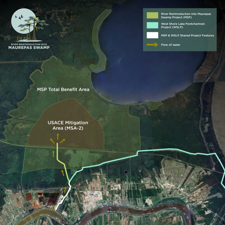
The MSP will utilize a channel constructed to connect the Mississippi River to the Hope Canal. The channel will run near the Mt. Airy neighborhood and cross River Road and Airline Highway before connecting with Hope Canal in the Maurepas Swamp.
WSLP Integration
In January of 2023, the United States Army Corps of Engineers (USACE) formally selected the MSP as mitigation for the West Shore Lake Pontchartrain (WSLP) project. This decision marks the first time USACE has used a CPRA-led project as mitigation. Once complete, MSP and WSLP will share levee features and boundaries near Mt. Airy. This unique approach is a significant milestone in CPRA’s history and capitalizes on common features to maximize flood protection and restoration efforts for St. John the Baptist Parish.
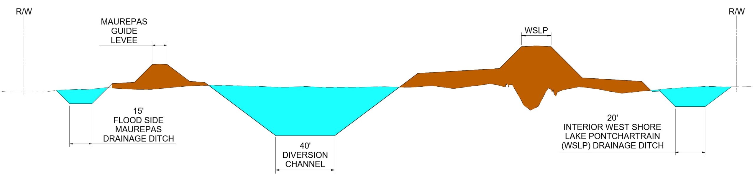
The schematic below displays how the MSP will integrate with WSLP once complete. The cross-section, shown looking north, highlights the connection between the two projects and how they utilize shared features to advance flood protection and hydrologic restoration simultaneously.
Construction Timeline
- 2024 – Construction begins at Hope Canal
- 2027 – Construction begins near Garyville
- 2030 – Estimated project completion
Construction Updates
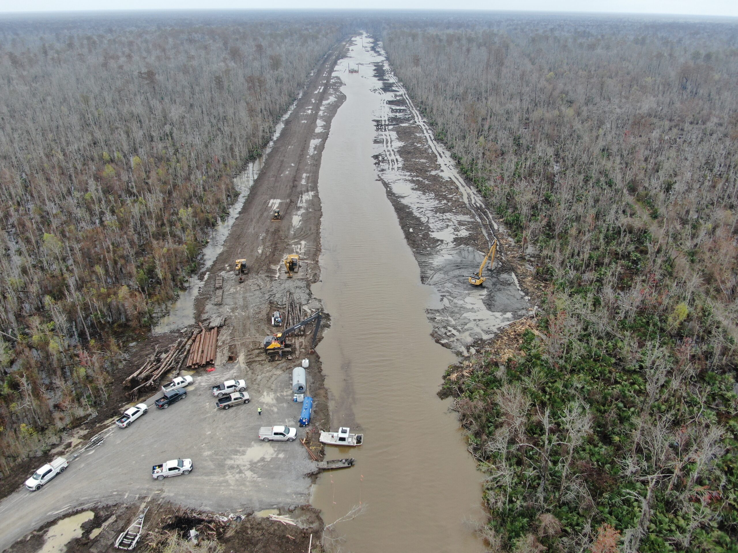
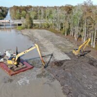
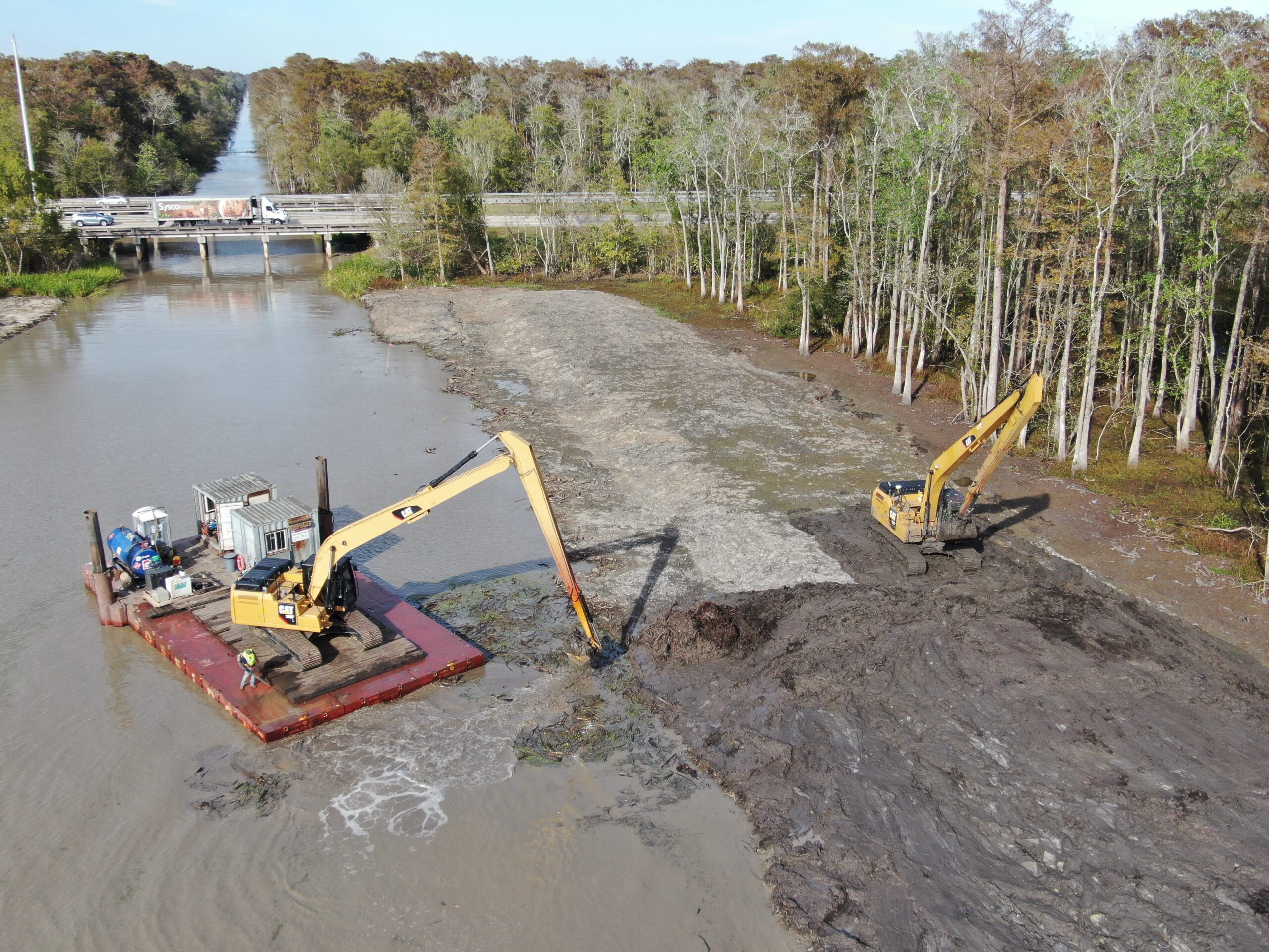
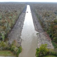
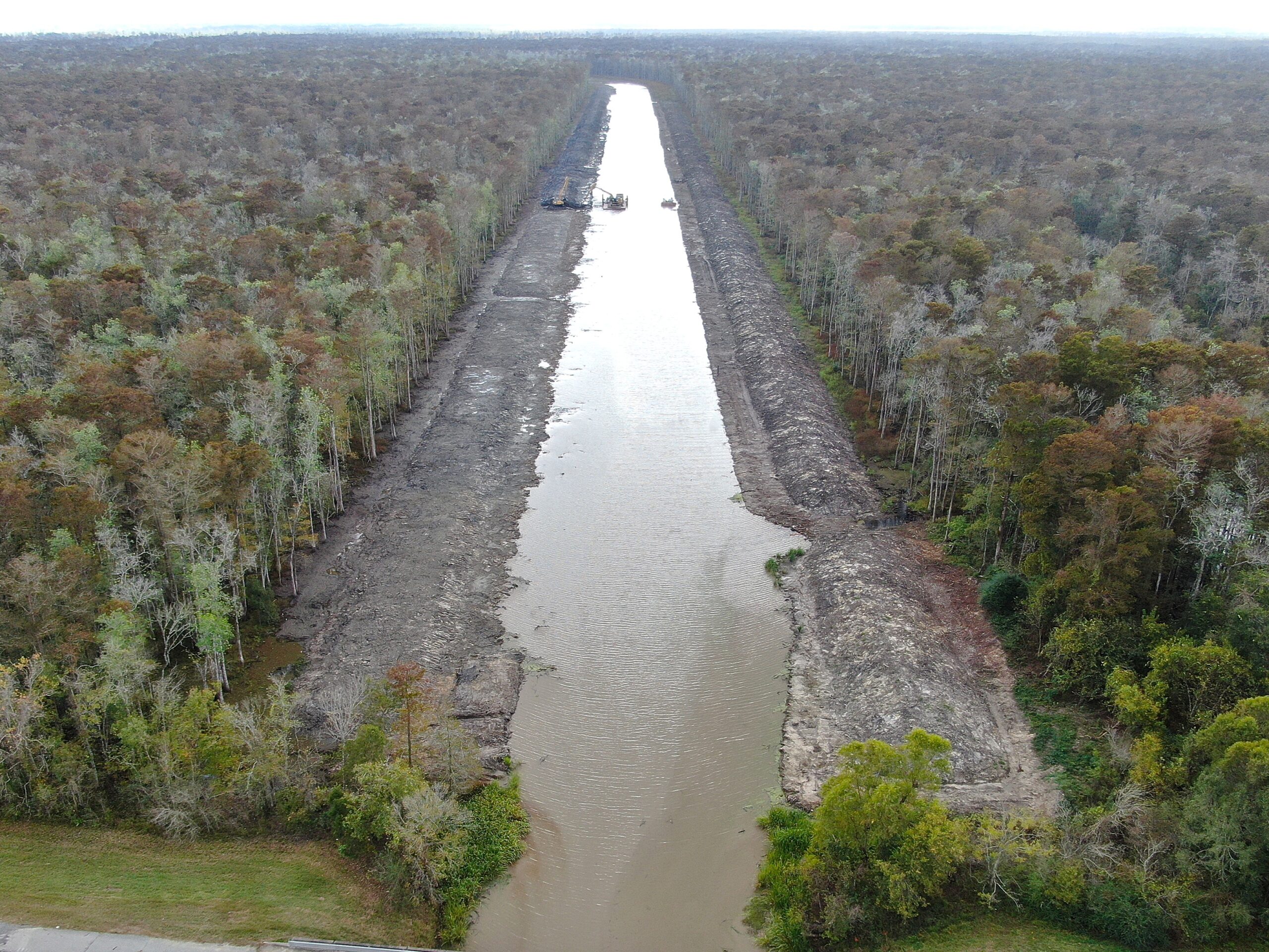
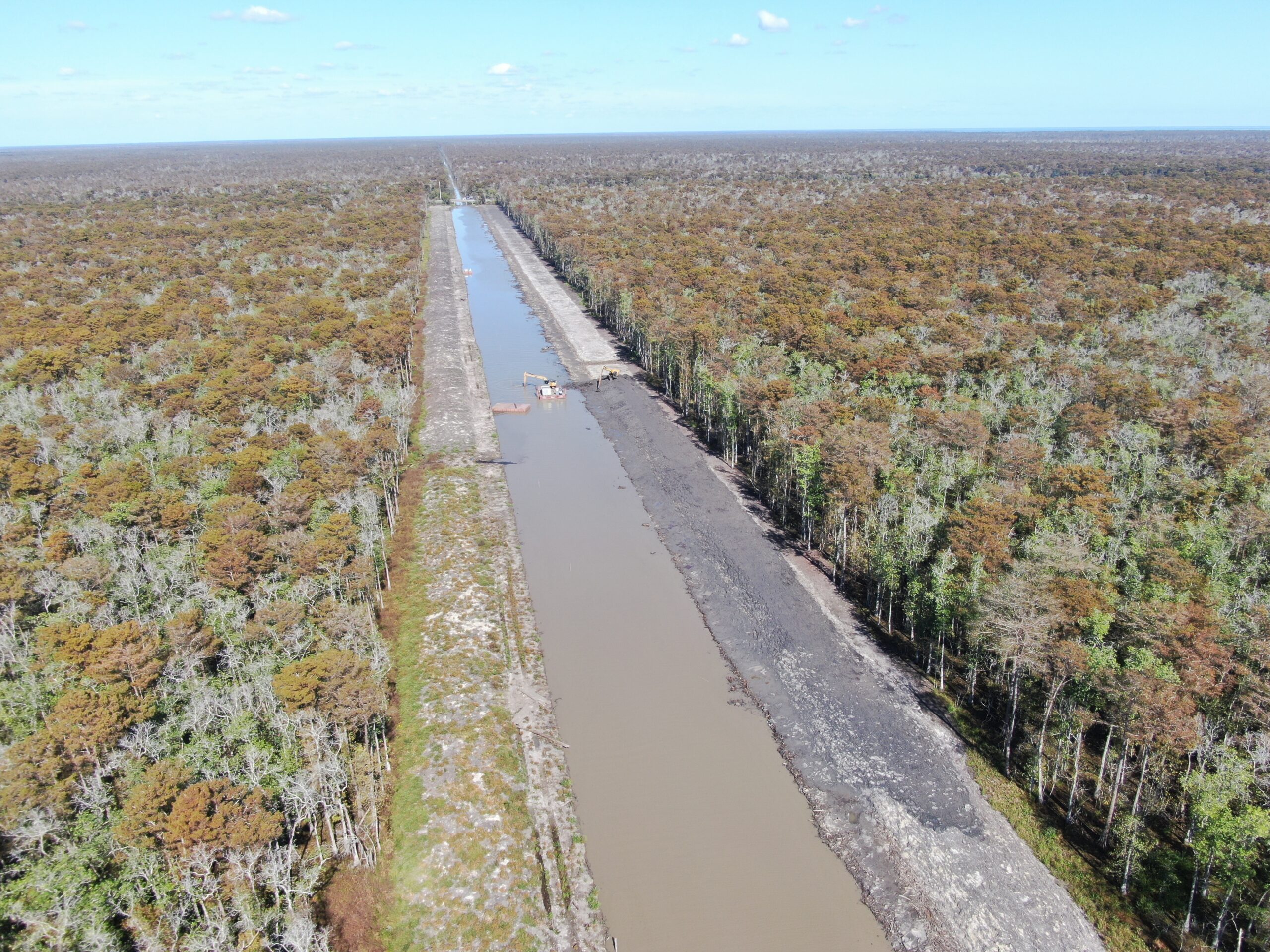
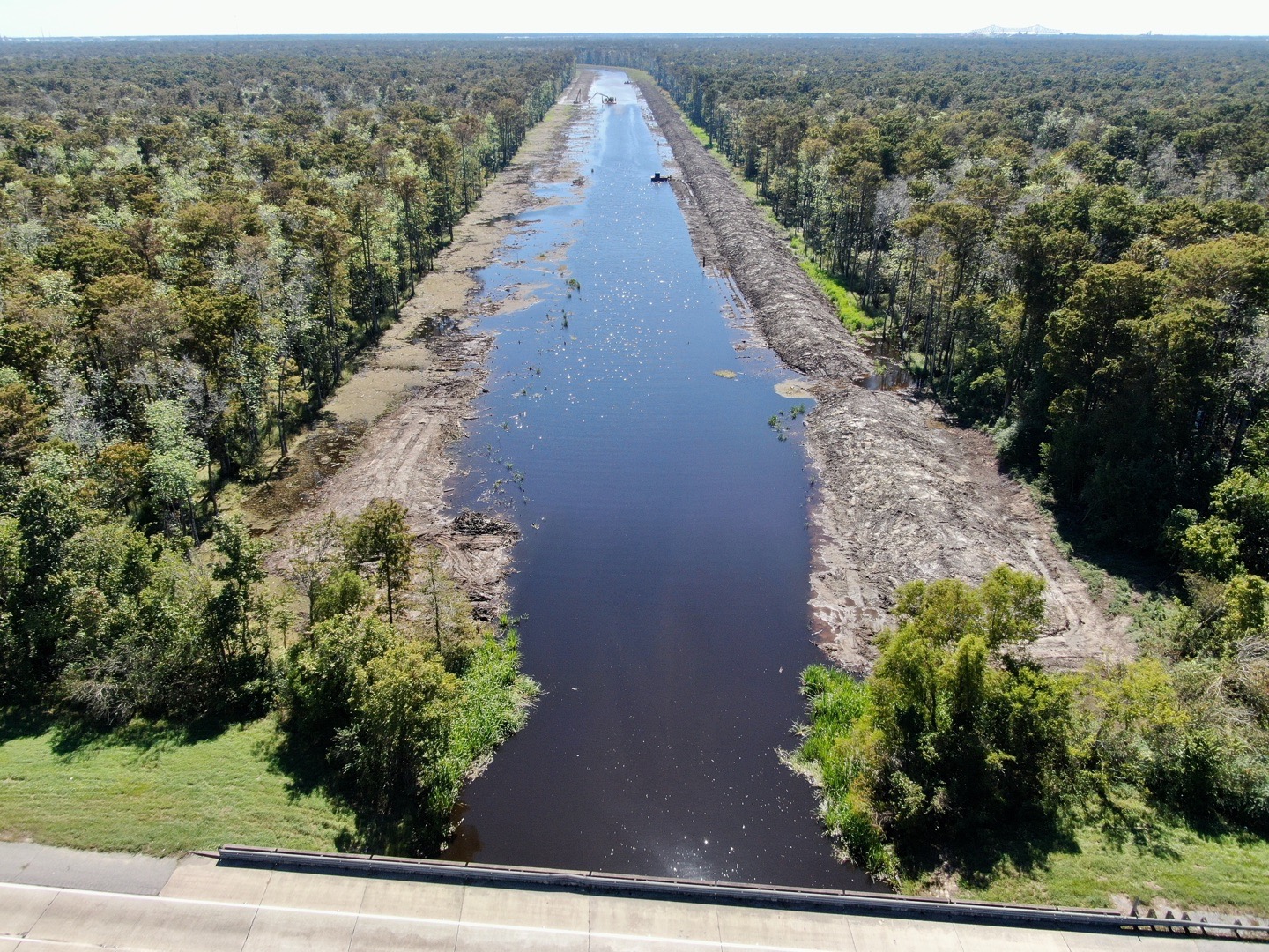
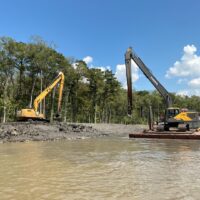
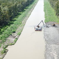
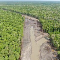
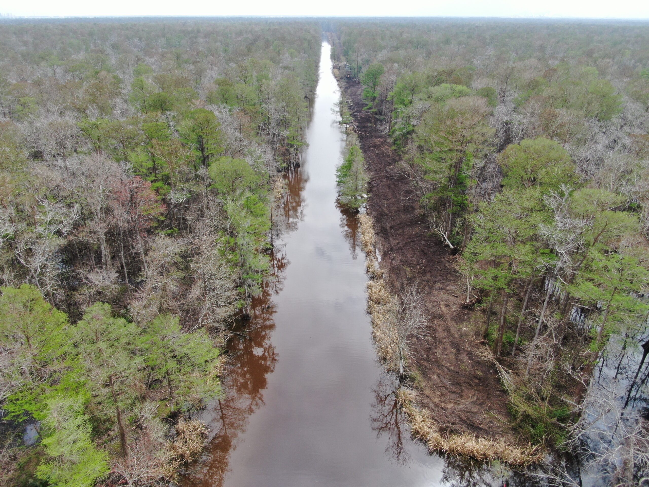
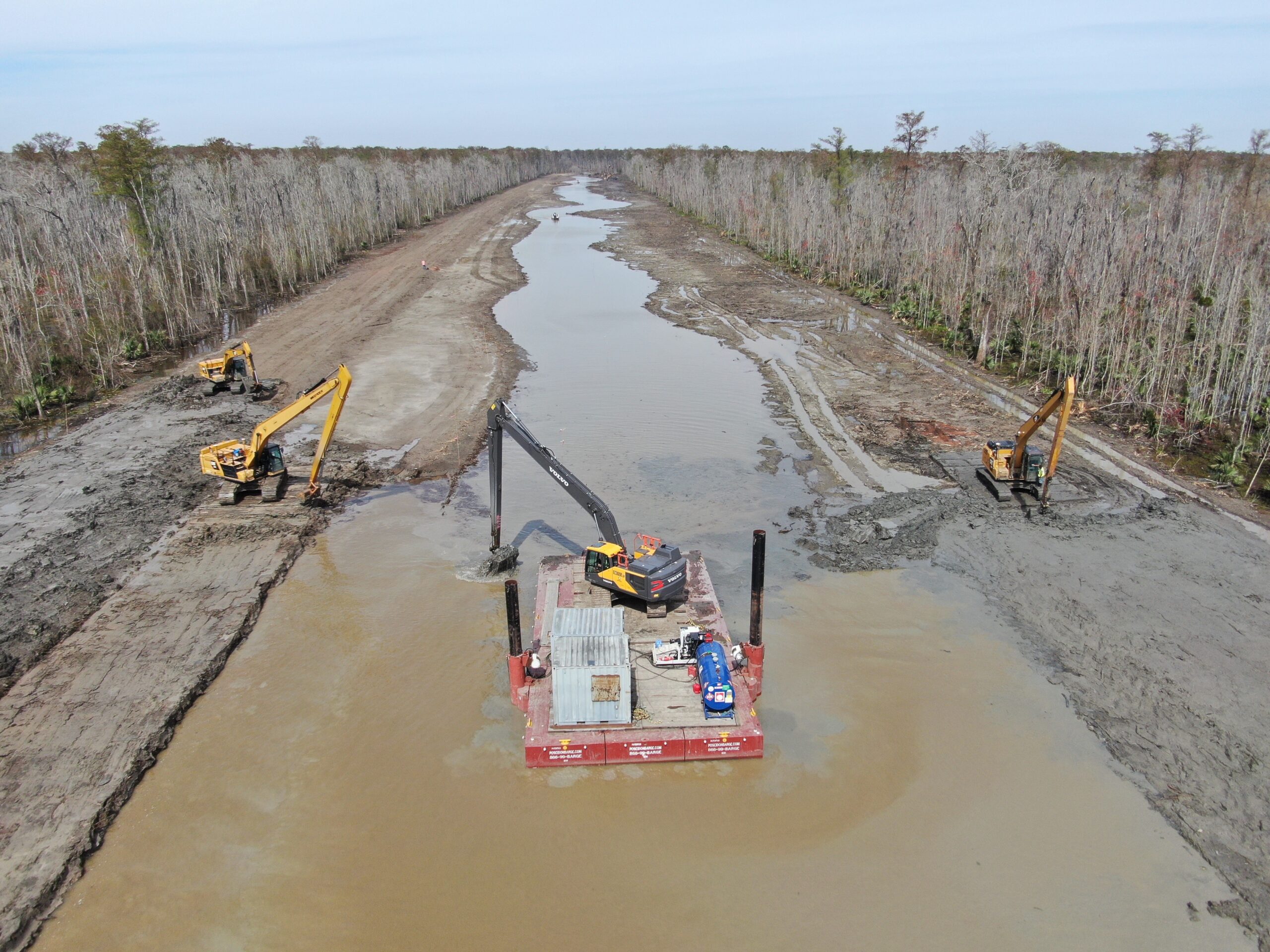
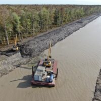
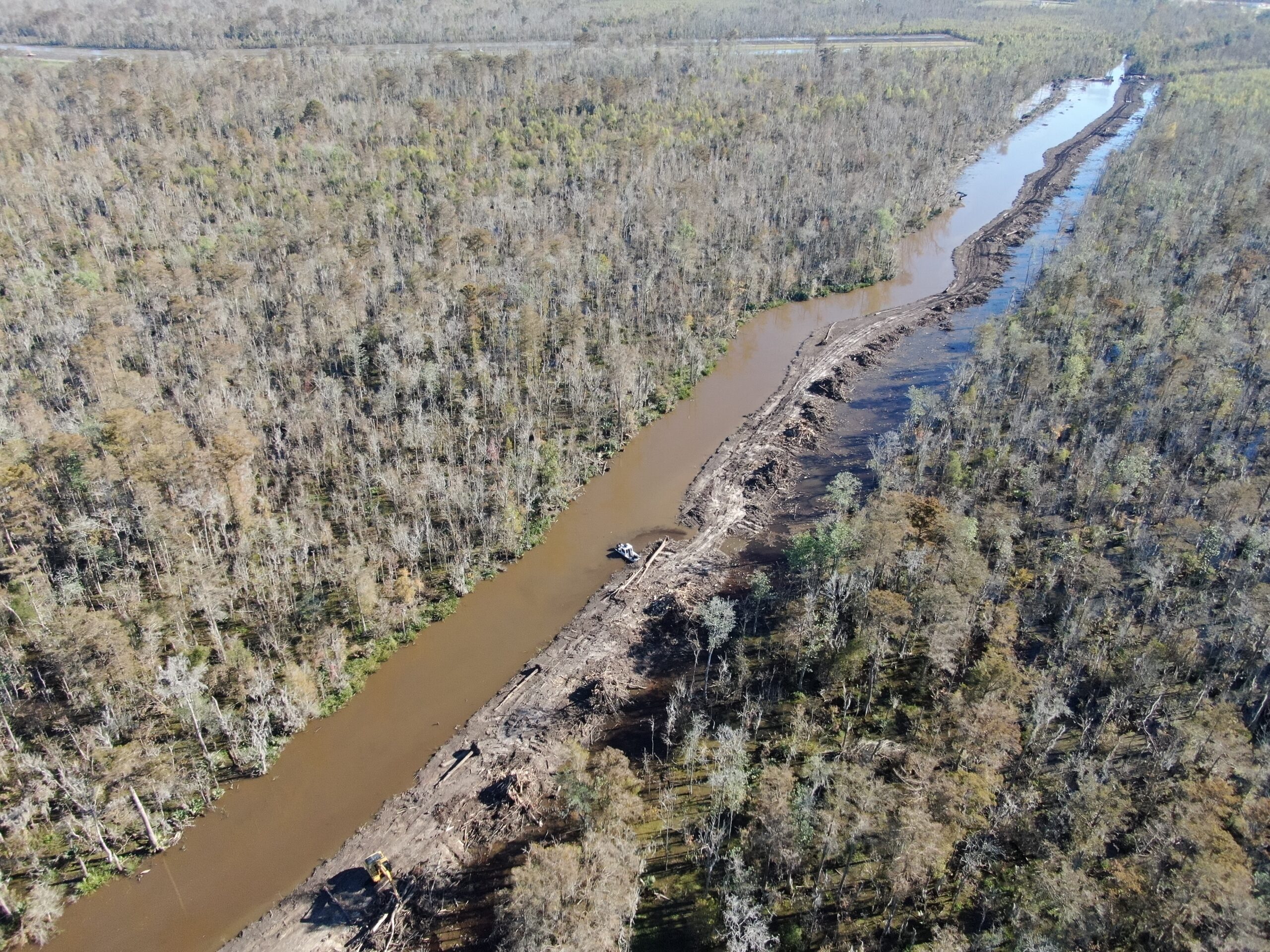
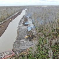
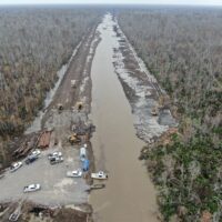
Construction is ongoing on Reach 6 near Hope Canal. Reach 6 Phase 1, the first phase of construction, is anticipated to be complete by early 2026.
REACH 6 CONSTRUCTION PROGRESS
Contact Us
Have questions about the River Reintroduction into Maurepas Swamp? Contact CPRA at maurepas@la.gov.
Upcoming Engagement Opportunities
Check back here for opportunities to learn more and provide your feedback on the River Reintroduction into Maurepas Swamp.
In the News
A Wing and a Prayer Country Roads, Nov. 22, 2019
Revitalizing the dying Maurepas Swamp has long been a goal. Work finally begins this fall, New Orleans Times Picayune, July 17, 2024
Construction is beginning on a project to send a lifeline to a dying Louisiana Swamp, Fox8 News, November 25, 2024
To save a dying swamp, Louisiana aims to restore the Mississippi River’s natural flow, Associated Press, December 3, 2024
Plan to revive this dying Louisiana swamp along Interstate 10 gets a big boost in funding, New Orleans Times Picayune, June 23, 2025
Maurepas Swamp’s upcoming reintroduction to the Mississippi River, The Lens, December 3, 2025
Groundbreaking ceremony marks milestone for $330 million effort to save Maurepas Swamp, Fox8 News, December 10, 2025
Photo Gallery
-
- Crew finishing up building the levee with the second pass on the East side at the end of the project
-
- View of the project from above the interstate looking south. On the East side Phylway is dredging and building levee with the 2nd pass
-

- Aerial view of the crew working on the 2nd pass headed north to the interstate

-

- Aerial View of the east bank levee being built with the 2nd pass. Currently at station 260+25 headed north to the interstate.
-

- Aerial view of site conditions looking from the Northern end at Interstate I-10 (Looking Southerly). West bank 2nd pass is complete. Currently working on building the levee with 1st pass on the east side.
-

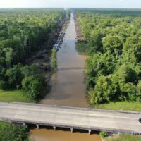
- View of the end of the project from above I-10 looking south (towards airline Hwy). The west side of the project is almost complete building the levee with the 2nd pass. On the east side the clearing and grubbing is almost complete.

-
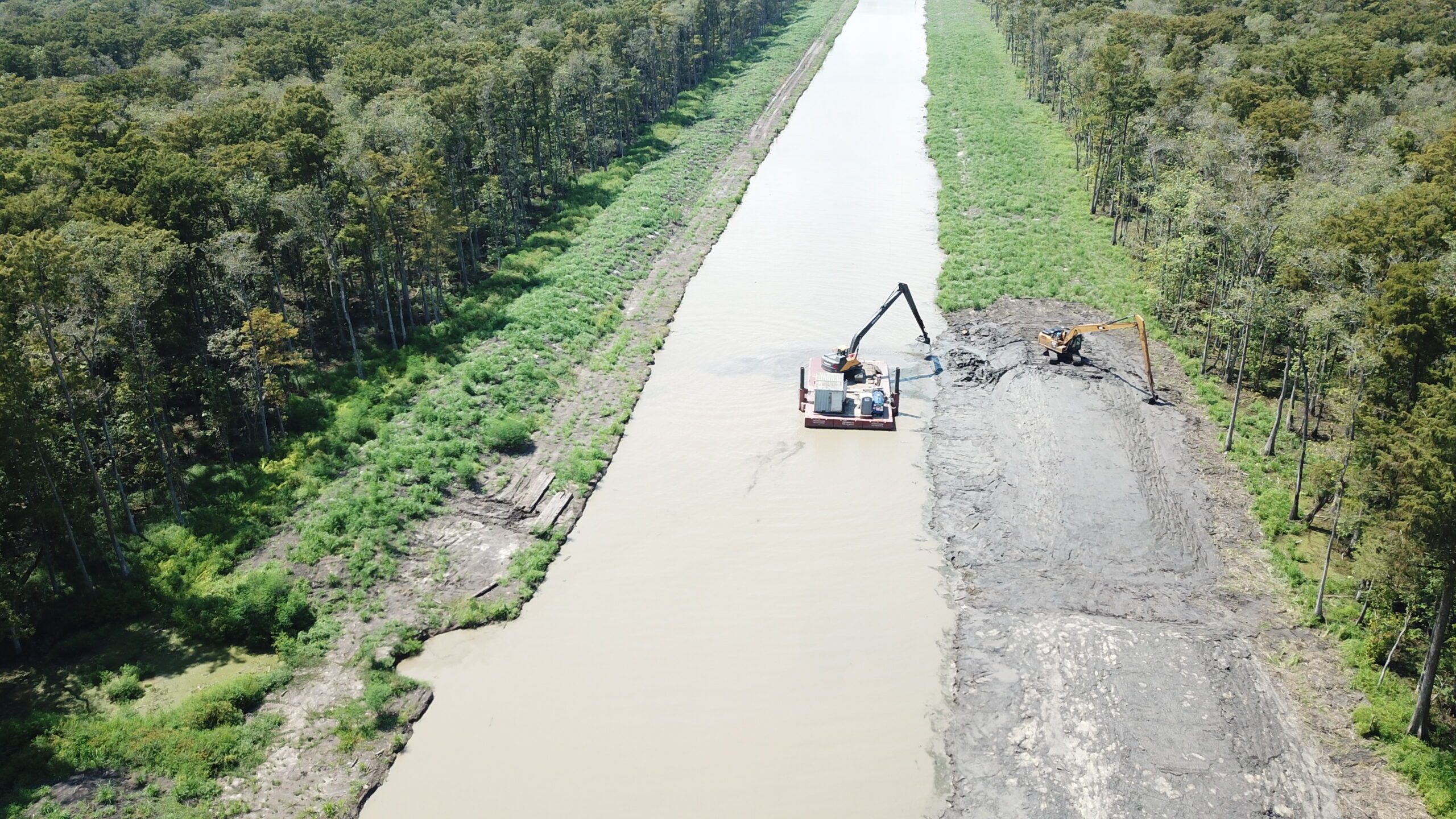
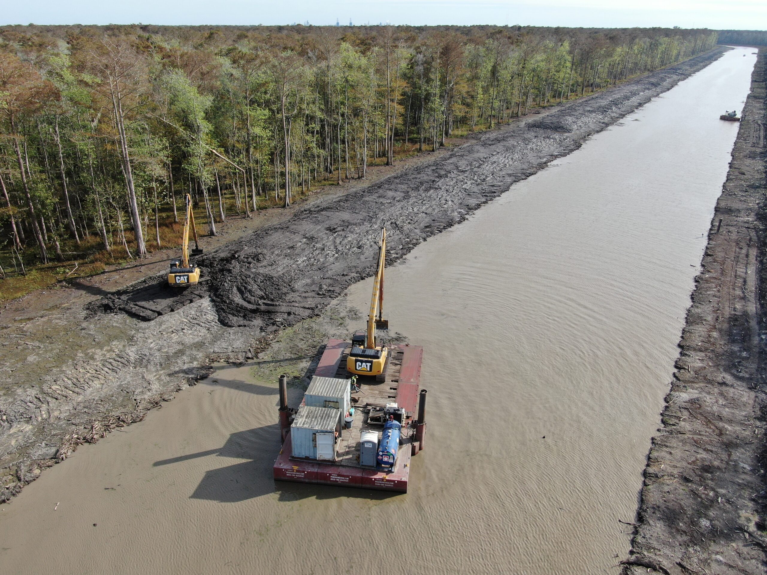
- View of Dredging and Levee construction in progress with 2nd Pass along East Bank, near Sta.: 213+25 (Looking Northeasterly).

-
- Aerial view of Dredging and Eastern Levee construction in progress near Sta.: 213+25, showing WBG-3 at Sta.: 211+16 (Bottom Left), and EBG-3 at Sta.: 211+80 (Bottom Right), (Looking Northwesterly).
-

- View from above the boat launch looking North showing both the east and west sides levees 1st pass complete.
-
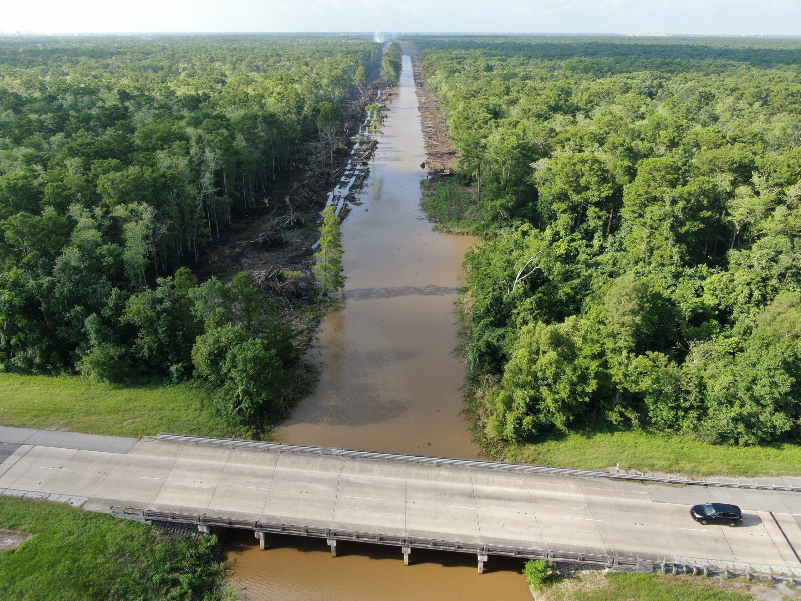
- View of the end of the project from above I-10 looking south (towards airline Hwy)
-
- View of area inside work limits between Sta.: 200+00 & 209+00 showing current construction and ridge opening for new canal (Looking North).

-
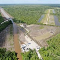
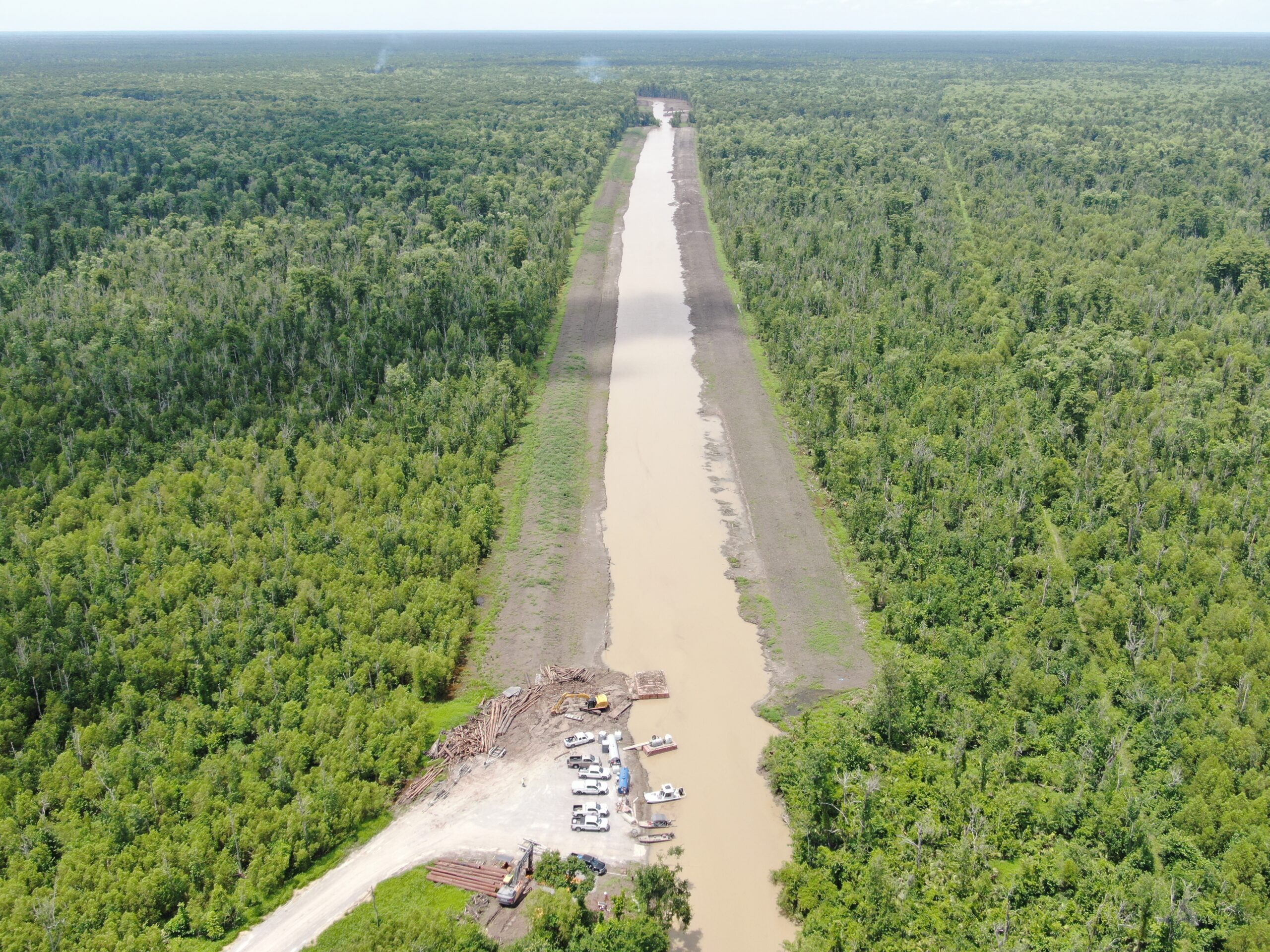
- Aerial photo from above Airline Hwy showing the access road to boat launch all the way on the left. On the farthest right you can see the West Shore Lake Pontchartrain Contract 110 levee and as you move towards Hope canal you can see construction on the WSLP 114a contract that will tie into the Maurepas Diversion.

-

- Aerial view of Hope Canal showing clearing work performed along West-bank up to Sta.:287+00 (looking South towards Airline Hwy)
-

- Aerial perspective view of work in progress at Hope Canal, dredging and building levees near station 155+50 (looking north).
-
- View of the crew finishing up building the levee with the 2nd pass on the East side at the end of the project
-
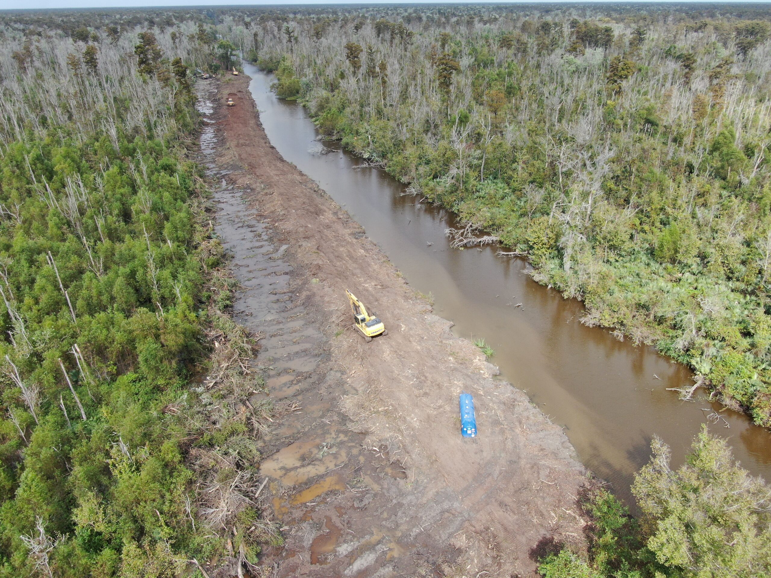
- Clearing operations began October 21, 2024. Aerial view of showing the cleared area along West Bank of Hope Canal (Looking North)
-

- Aerial view of showing equipment clearing trees and creating debris burn piles along West bank before the pipeline corridor.

-

- Aerial view of clearing and grubbing progress on the West bank looking south west. (boat launch is in top right of photo). Crews are clearing along the east bank and piling up debris on the west bank near the pipeline corridor.
-

- View of the project looking North. To the left is where the access road/boat launch is being built.

-
- View from above the boat launch looking North. Crews working on building the staging area/boat launch. Also, clearing and grubbing on the East & West sides of the project & shaping west bank levee.

-

- View from above the boat launch looking North. Crews clearing and grubbing on the East & West sides of the project.

-
- View from just before the boat launch looking North. You can see the access road leading to the boat launch on the left. Crews clearing and grubbing on the East & West sides of the project.